Children's US and US-Centered World Desk Map
- Regular price
- $9.75
- Sale price
- $9.75
- Regular price
-
- Unit price
- /per
Sale
Sold out
Shipping calculated at checkout.
Adding product to your cart
A Unique 2-sided Desk Map
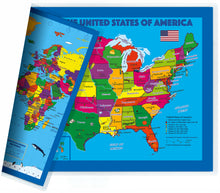
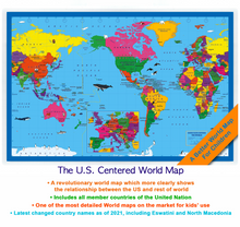
A Children's US centered world map on one side and a US map on the other;
17.5 x 11.5 inches, perfect for using on desk or table.
- THE MAPS ARE DETAILED AND ACCURATE EVEN THOUGH IT IS MAINLY FOR CHILDREN’S USE.
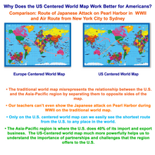
- This world map is the best world map for Americans, because the traditional world map misrepresents the relationship between the U.S. and the Asia-Pacific region by separating them to opposite sides of the map; our teachers can’t even show the Japanese attack on Pearl Harbor during WWII on the traditional world map.
- Only on the U.S. centered world map can we easily see the shortest route from the U.S. to any place in the world. The Asia-pacific region is the fastest growing area in the world. It contains 60% of the world’s population and 8 of the G20 countries, where the U.S. does 40% of its import and export business. This U.S. centered world map much more powerfully helps us to understand the importance of partnerships and challenges that the region offers to the U.S.
-
The USA map features all state capitals and the top 50 largest metro areas. Also it includes the Great Lakes, the largest mountain ranges and 10 largest rivers in the USA.
- THE WORLD MAP CONTAINS AN INSET OF EUROPE AT A LARGER SCALE TO MAKE IT EASIER TO READ THE COUNTRY NAMES AND CAPITALS FOR THE MOST CROWDED AREA IN THE WORLD.
Features:
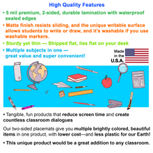
- 2-in-1 : Get both US and world maps for the cost of one, so it’s super convenient, it’s a great value, and it’s using less plastic for our Earth!
- 5 mil premium 2-sided durable lamination with waterproof sealed edges, will survive tough use.
- Shipped flat, lies flat on your desk, and unique writable matte finish allows you to easily mark your special places and trips. Tangible, fun products that reduce screen time and create countless family conversations!
Special Deals For Schools With Purchase Of 20 Or More
We’re providing exclusive wholesale deals with 40% off for an order of 20 or more pieces.
The numbers of items could be all one item or any combination. You will see the corresponding discounts in your cart automatically before you check out.
Still not sure?
Our stress-free return policy makes it easy for you to decide. You can return any of our products in any condition within 30 days, for any reason.
Use left/right arrows to navigate the slideshow or swipe left/right if using a mobile device


